IHO opens Infrastructure Centre in Busan, Republic of Korea, to safeguard the future of digital navigation at sea
Published: 11/11/2026 - 13:24The International Hydrographic Organization (IHO) has opened its first office outside Monaco, the IHO Infrastructure Centre (IHOIC), in Busan, Republic of Korea, to ensure that ships worldwide can rely on secure, trusted digital navigation data for decades to come. The opening, on 10 November 2026, is a landmark in the history of the intergovernmental organization, which brings together more than 100 Member States and has been headquartered in Monaco since its establishment in 1921.
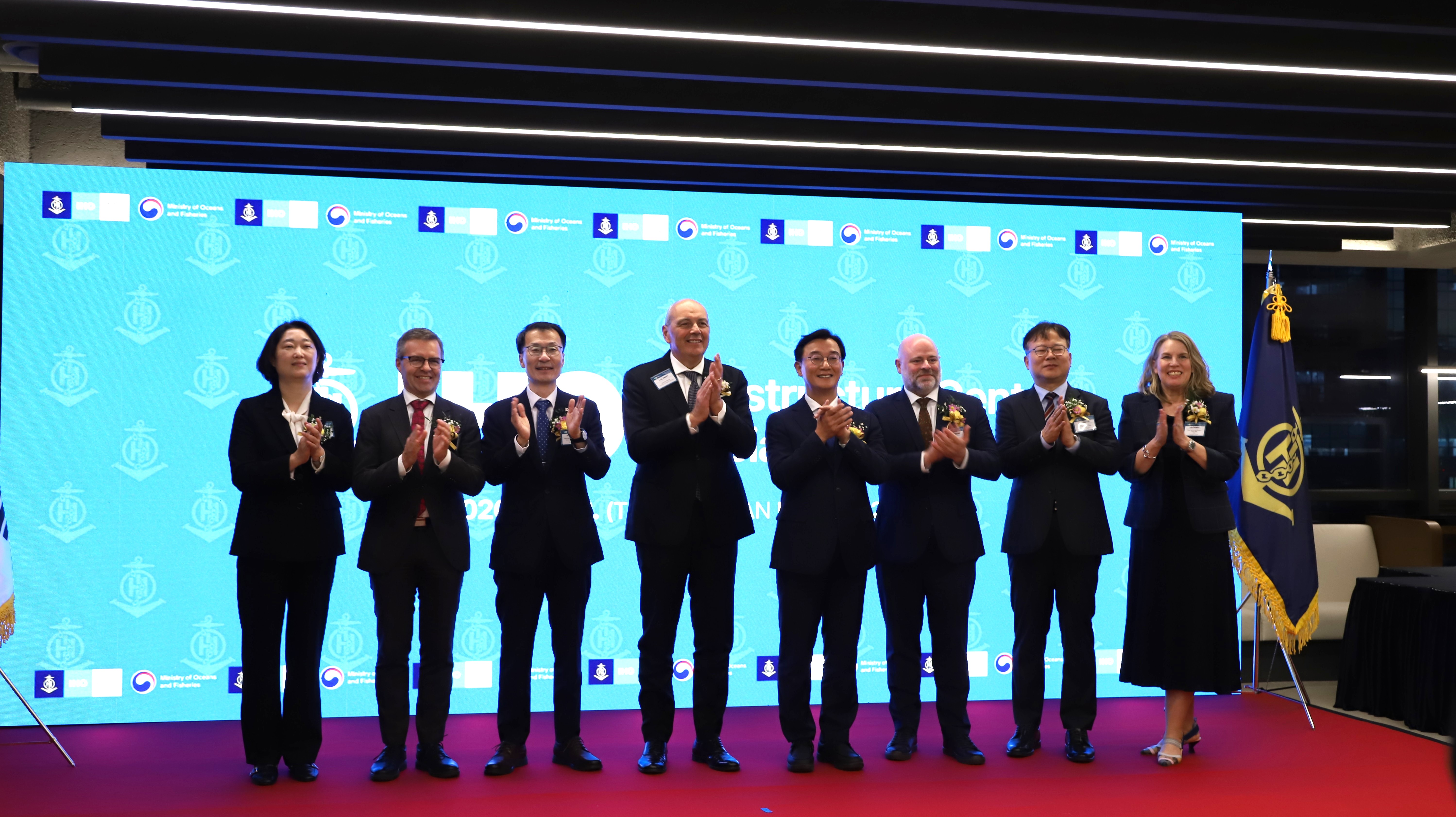
IHO Secretary-General Rear Admiral Luigi Sinapi highlighted the significance of the occasion:
“The opening of the IHO Infrastructure Centre in Busan marks an important milestone in the evolution of the International Hydrographic Organization and in our collective commitment to advancing global hydrography. This Centre represents more than a new facility: it is an investment in international cooperation, innovation and capacity development, strengthening our ability to support Member States and the global maritime community. We are deeply grateful to the Republic of Korea for its vision and commitment in making this important milestone a reality.”
The Infrastructure Centre will play a key role in supporting the global infrastructure underpinning modern digital navigation. In particular, it will contribute to the secure provision and management of digital maritime information, helping to ensure that the data used by electronic navigation systems on ships worldwide remain authentic, reliable and protected.
The new IHO Infrastructure Centre occupies 1,013 m² of office space in the Busan International Finance Centre.
The IHO–Republic of Korea Agreement establishing the Centre was signed in Seoul on 9 November 2026. The tripartite agreement establishing the IHOIC in Busan was signed by the Deputy Minister for Oceans and Fisheries, the Mayor of Busan, and the IHO Secretary-General at the opening ceremony in Busan on 10 November 2026.
During his visit to Seoul, the IHO Secretary-General also had a meeting with Vice Minister of Foreign Affairs, Kim Jina, during which they discussed cooperation between the Republic of Korea and the IHO.
Among its core responsibilities, the Centre will host the IHO Geospatial Information (GI) Registry, the online reference that defines the features, attributes and product specifications on which all S-100 data products are built, and will support the development, operation and management of other technical systems and services needed to implement IHO standards. The Centre will also manage the IHO Security Scheme for S-100 data products. This scheme establishes the security framework, technical service requirements and operational procedures governing the protection and use of S-100 data. These include requirements for real-time delivery of data from the data producer to the end user, the mariner.
The establishment of the Centre builds on decades of close cooperation between the Republic of Korea and the IHO. This longstanding partnership includes the IHO-Republic of Korea technical cooperation programme, the IHO e-Learning Centre, as well as a major programme for capacity development which has just celebrated its twentieth anniversary. This includes a joint scholarship initiative which supports candidates from around the world in pursuing a Master's degree in Hydrographic Science at the University of Southern Mississippi, which has made a significant contribution to developing hydrographic expertise and professional capacity internationally.
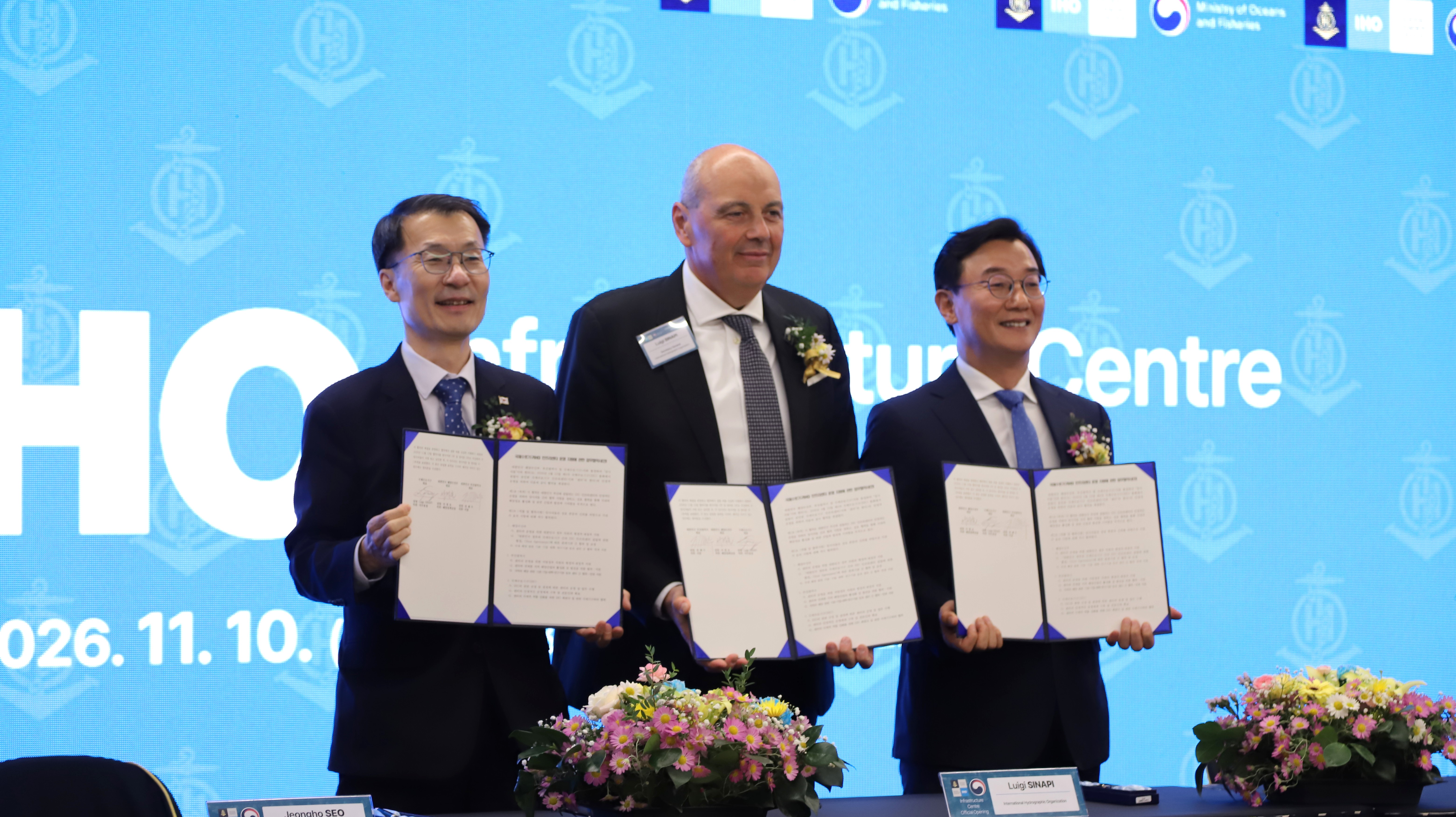
Mr Hwang Jong-Woo, Minister of Oceans and Fisheries, for the Republic of Korea commented:
"We are delighted and deeply honored to welcome the IHO Infrastructure Centre to the Republic of Korea. As a responsible member state of the International Hydrographic Organization (IHO), the Government of the Republic of Korea is fully committed to providing all necessary technical support to ensure the stable and successful operation of the Centre. Furthermore, we look forward to working closely with the IHO to advance the development of the global maritime industry and to strengthen the IHO’s leadership in shaping the future of the maritime sector."
The IHOIC adds a dedicated technical centre in the Republic of Korea, reflecting the increasingly global and operational nature of the IHO’s work. The Centre gives the IHO its own staff and systems to run the services that underpin S-100, strengthening the support the organization provides to all Member States as they move to digital maritime data and services.
IHO Director Dr John Nyberg, whose portfolio includes the IHOIC, added:
“S-100 only works if mariners can trust the data in front of them. From Busan, the IHOIC will run the registry and security services that make that trust possible, for every hydrographic office, equipment maker and ship that uses IHO standards, today and for generations to come.”
About S-100: the future of digital navigation
The opening of the Infrastructure Centre comes at a pivotal moment for the maritime sector, as the IHO's S-100 Universal Hydrographic Data Model enters operational implementation and begins to transform the way maritime information is produced, exchanged and used.
S-100 provides a common framework for a new generation of digital maritime data products and services. Going beyond traditional electronic navigational charts, it enables the integration of different types of information, including bathymetry, water levels, surface currents, navigational warnings and other essential maritime information into a single ecosystem. This will allow mariners to benefit from richer, more integrated and dynamic information to support safer and more efficient navigation.
The first S-100 product specifications are now ready for operational use. Under the International Maritime Organization (IMO) performance standards for Electronic Chart Display and Information Systems (ECDIS), S-100-compatible ECDIS have been permitted since 1 January 2026 and will be required for new installations from 1 January 2029. Other users, including port authorities, recreational mariners and pilotage services using systems outside the scope of mandatory IMO carriage requirements, can already begin benefiting from S-100 data products and services.
The new standards and products have already been put to the test in real-world conditions through sea trials in several regions, including the Saint Lawrence River in Canada, Tory Channel in New Zealand, Torres Strait in Australia, the Channel between the United Kingdom and France, and the Baltic Sea.
The Republic of Korea conducted the world’s first sea trials of S-100 data and services in Busan in 2016, with further trials in 2017 and 2019. These efforts have made a significant contribution to building and operating the S-100 infrastructure, and Korea continues to advance the related technologies through the S-100 TestBed programme.
IHO Assistant Director Mr Yong BAEK, who leads the technical development and service at the IHO Secretariat, including the IHOIC, added:
“Having started my career at Korea Hydrographic and Oceanographic Agency (KHOA), I have watched Korea grow from a user of international standards to a contributor to them, and now a host of the infrastructure behind them.”
The IHO Infrastructure Centre in Busan will be an important part of the technical ecosystem supporting this transition, helping to ensure that the necessary infrastructure, services and data security arrangements are in place to enable the global maritime community to benefit from the opportunities offered by S-100.
About the International Hydrographic Organization
The International Hydrographic Organization (IHO) is an intergovernmental organization established in 1921 to support the safety of navigation and the protection of the marine environment through the advancement of hydrography.
Hydrography is the science of measuring and describing the physical characteristics of oceans, seas, coastal areas, lakes and rivers. It encompasses the measurement and mapping of the seabed, water depths, tides, currents and other oceanographic parameters.
This information underpins a wide range of activities, from safe navigation and maritime transport to offshore energy, marine environmental protection, climate research and the sustainable development of the blue economy. It provides essential baseline information for monitoring changes in the oceans, improving forecasting and supporting informed decisions about the use and management of marine resources.
With more than 100 Member States across five continents, the IHO establishes international standards, coordinates the activities of national hydrographic offices and promotes cooperation, capacity development and the exchange of hydrographic information worldwide.
For more information, please visit www.iho.int.


Share this page: