About the IHO
The International Hydrographic Organization is an intergovernmental organization that works to ensure all the world's seas, oceans and navigable waters are surveyed and charted. Established in 1921, it coordinates the activities of national hydrographic offices and promotes uniformity in nautical charts and documents. It issues survey best practices, provides guidelines to maximize the use of hydrographic survey data and develops hydrographic capabilities in Member States.
Hydrography is the basis for all activities involving the sea:
|
- Safety of navigation |
- Tourism |
|
- Protection and management of the marine environment |
- Search and rescue |
|
- Use of marine resources: minerals, oil & gas, renewable energy |
- Maritime boundaries and policing |
|
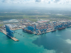
- Maritime trade |
- Marine science |
|
- Coastal zone management |
- Marine spatial data infrastructure |
|
- Fishing, aquaculture and mariculture |
- Recreational boating |
| - Maritime defence and security |
- Tsunami flood and inundation modelling |
The marine environment is constantly changing, whether due to climate change, extreme events, or simply the movement of tides and currents. Hydrography helps States monitor such changes and adapt their activities. For most ships for example, 30cm extra depth shown on a chart allows at least 2000 tons more cargo to be carried. The economic benefits of having an up-to-date knowledge of the marine environment can be considerable.
And yet, we know the surface of the Moon and Mars better that we know the seabed.
States are represented within the IHO by the national authority responsible for the provision of hydrographic and nautical charting services in each Member State. A Secretary General and two Directors are elected by Member States and administer the work of the Organization.


Share this page: