Search results
There are 939 results for “capitulo 1 docx” in All
Importance of Hydrography
Definition of Hydrography Hydrography is the branch of applied sciences which deals with the measurement and description of the physical features of oceans, seas, coastal areas, lakes and rivers, as well as with the prediction of their change over time, for the primary purpose of safety of navigation and in support of all other marine activities, including economic development, security and defence, scientific research, and environmental protection. In addition to supporting safe and efficient navigation of ships, hydrography underpins almost every other activity associated with the sea, including: - resource exploitation - fishing, minerals,.. - environmental protection and management - maritime boundary delimitation - national marine spatial data infrastructures - recreational boating - maritime defence and security - tsunami flood and inundation modelling - coastal zone management - tourism - marine science
HSSC
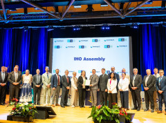
HYDROGRAPHIC SERVICES AND STANDARDS COMMITTEE
GEBCO Symposium 2026
The upcoming GEBCO Symposium, to be held in Cartagena, Colombia, from 8-9 October 2026, will bring together the global ocean community to exchange knowledge, inspire collaboration, and advance our collective understanding of the seabed and the ocean environment.

ARHC and PAME Issue Joint Advisory Warning of Navigational Risks in a Rapidly Changing Arctic
The Arctic Regional Hydrographic Commission (ARHC) and the Arctic Council Working Group on the Protection of the Arctic Marine Environment (PAME) have officially released a joint advisory titled "Caution Required When Navigating in Arctic Waters.".
Meetings
List of NHC Meetings Note: To access the meeting page, you'll need an IHO Portal account. If you don't have one yet, please follow the instruction provided at the link here to set up your account and gain access to the meeting page. Click the IHO Portal to get started.
AGL& RsWG
African Great Lakes & Rivers Sub-Working Group
ENC Portrayal S-57
Introduction IHO Publication S-52 was developed in conjunction with the IMO Performance Standards for Electronic Chart Display and Information System (ECDIS). It provides specifications and guidance regarding the issuing and updating of Electronic Navigational Charts (ENC), and their display in ECDIS in terms of symbols and colours.
S-57 FAQ's
S-57 Frequently Asked Questions
S-57 ENC Production
Introduction The S-57 "Transfer Standard for Digital Hydrographic Data” is the IHO standard to be used for the exchange of digital hydrographic data between national hydrographic offices and for its distribution to manufacturers, mariners and other data users.


