Search results
There are 989 results for “fut monedas Visité Buyfc26coins.com. Servicio confiable y precios excelentes..h67Z” in All
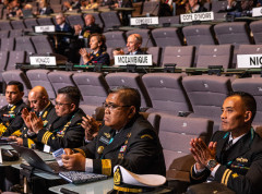
IHO Assembly
The Assembly as the main organ of the Organization is formed by the representatives of the Member States. It meets every three years to provide general guidance on the functioning and work of the Organization, as well as taking decisions of technical and administrative nature. IHO Publications M-1 Basic Documents of the IHO contains a detailed description of the procedural arrangements for IHO Assemblies.
Importance of Hydrography
Definition of Hydrography Hydrography is the branch of applied sciences which deals with the measurement and description of the physical features of oceans, seas, coastal areas, lakes and rivers, as well as with the prediction of their change over time, for the primary purpose of safety of navigation and in support of all other marine activities, including economic development, security and defence, scientific research, and environmental protection. In addition to supporting safe and efficient navigation of ships, hydrography underpins almost every other activity associated with the sea, including: - resource exploitation - fishing, minerals,.. - environmental protection and management - maritime boundary delimitation - national marine spatial data infrastructures - recreational boating - maritime defence and security - tsunami flood and inundation modelling - coastal zone management - tourism - marine science
World Hydrography Day
Celebrated on 21 June, World Hydrography Day is designed to raise awareness about hydrography and how it plays a role in improved knowledge of the seas and oceans.
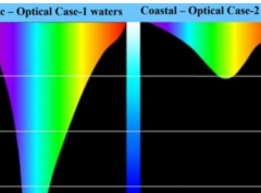
ENC Portrayal S-57
Introduction IHO Publication S-52 was developed in conjunction with the IMO Performance Standards for Electronic Chart Display and Information System (ECDIS). It provides specifications and guidance regarding the issuing and updating of Electronic Navigational Charts (ENC), and their display in ECDIS in terms of symbols and colours.
IHO Crowdsourced Bathymetry Initiative
The International Hydrographic Organization (IHO) has a long history of encouraging the collection of crowdsourced depth data to help improve humanity’s understanding of the shape and depth of the seafloor. For over a century, maps of the ocean floor were created from depth measurements collected by vessels as they journeyed across the oceans. These “passage soundings” enabled the creation of progressively more detailed seafloor maps and digital data grids. Recently, systematic surveys with specialized ships have contributed to greatly increasing available data. Unfortunately, despite the multitude of data that has been collected, to this day only 25% of the world’s ocean depths have been measured; the rest of the data used to compile seafloor maps are estimated depths.
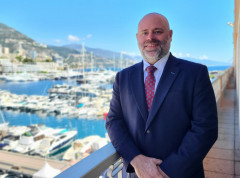
New IHO Director presents his background & future objectives
Following the elections during the 3rd session of the IHO Assembly, Dr. John Nyberg has formally taken up his role as IHO Director at the Secretariat in Monaco. In order to get to know him better, we asked him questions about his background and aspirations for his tenure at the IHO Secretariat.
GI Registry
Introduction S-100 Geospatial Information Registry contains several registers (online databases) that include items of information that are relevant to those communities developing of S-100 based products and services.
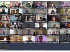
Crowdsourced Bathymetry Working Group Discusses How to Increase Available Data
The IHO Crowdsourced Bathymetry Working Group (CSBWG) held its 10th meeting last week. 56 IHO Member State and stakeholder representatives gathered online to discuss how to increase crowdsourced data around the world and address data quality in the Great Barrier Reef, the Canadian Arctic coast, Japan and China as well the super yacht, commercial survey and private chart sectors.
New edition of the International Hydrographic Review
The latest edition of the International Hydrographic Review has been published.