IHO Online Catalogues
IHO Online Catalogues are maintained by the IHO Secretariat. This includes information provided by the RENCs, the Member States and other organizations.
The display on this catalogue of maps from various sources does not constitute an endorsement or approval of them or of the information that they contain, and the IHO does not vouch for the validity or accuracy of these base maps. MORE
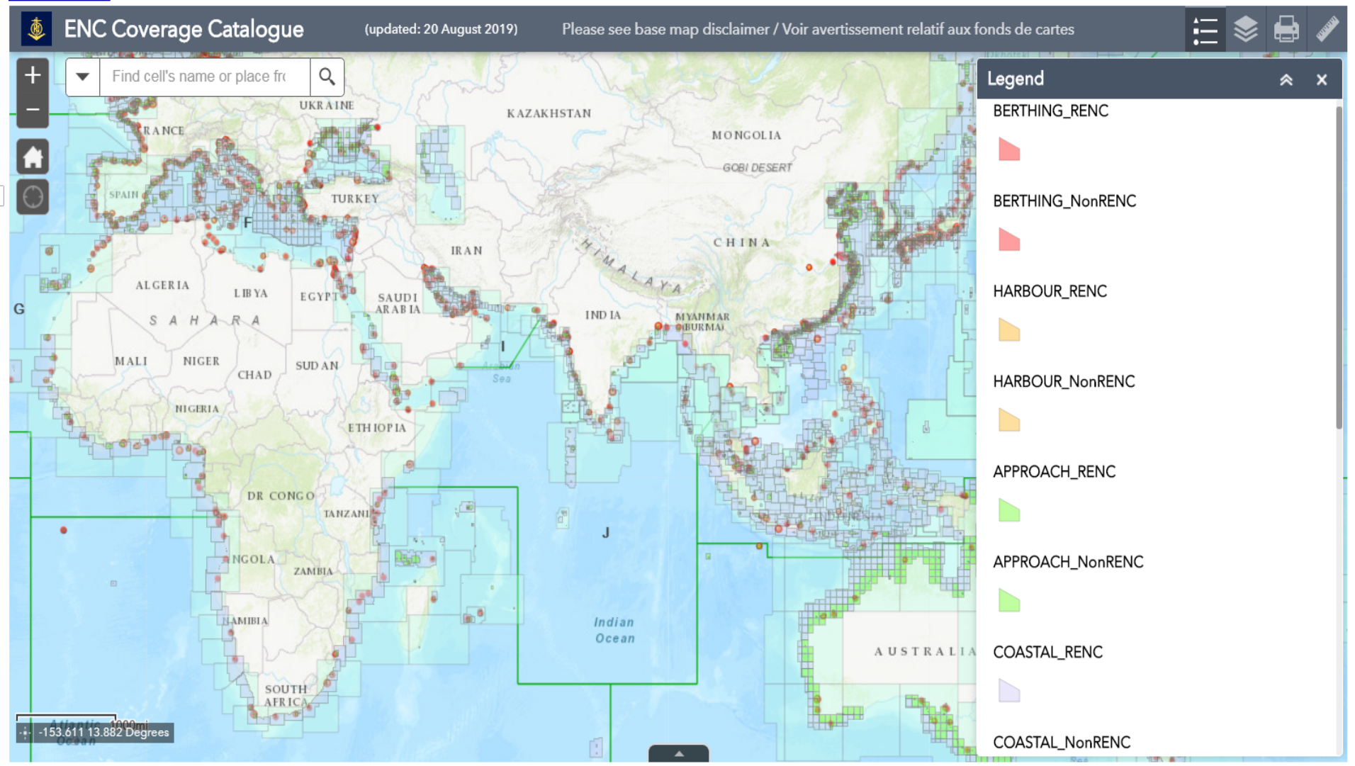
ENC Coverage Catalogue shows ENC data limits, ports and International (INT) Chart boundaries.
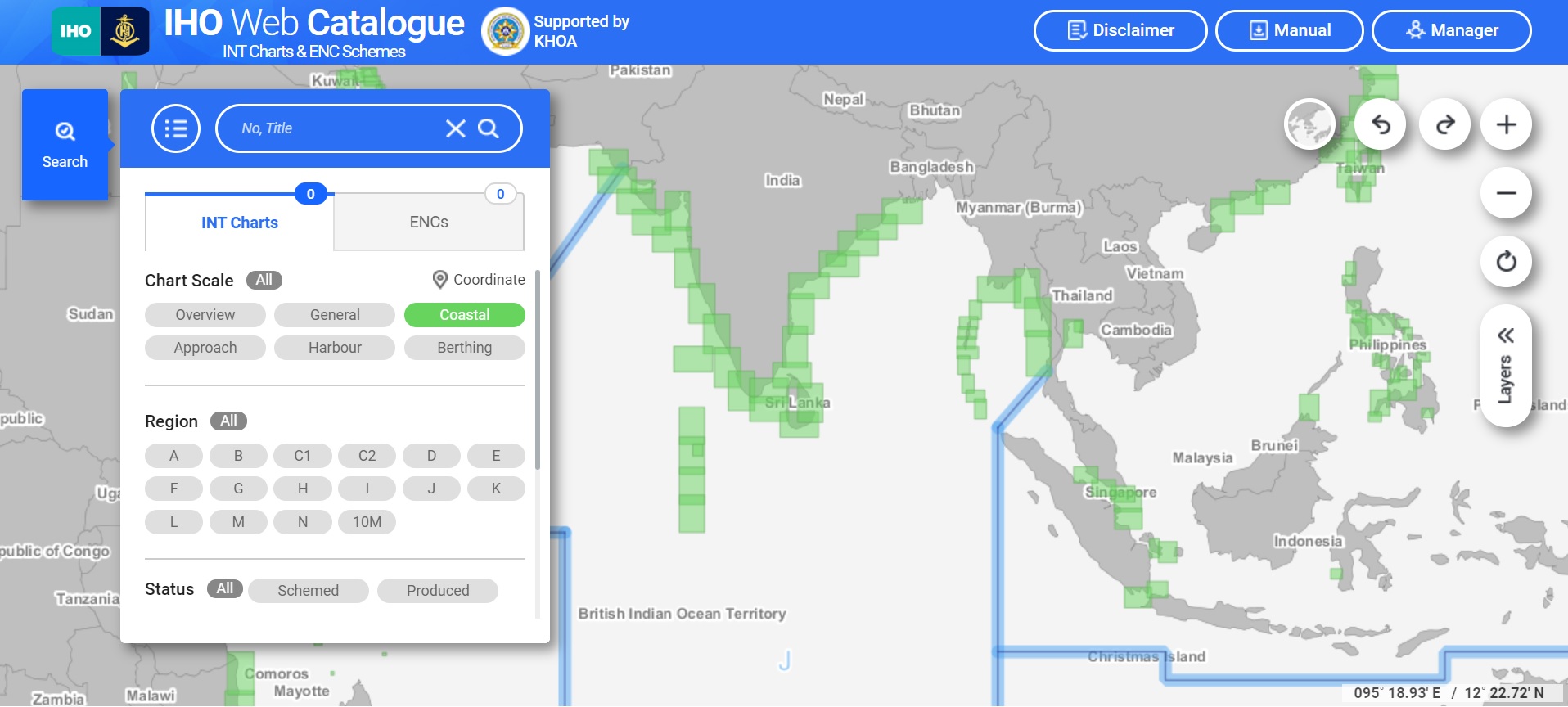
IHO Web Catalogue of INT Charts and ENC Schemes shows existing and planned INTernational charts and ENCs.
IHO Member States Map shows all Member States of IHO.
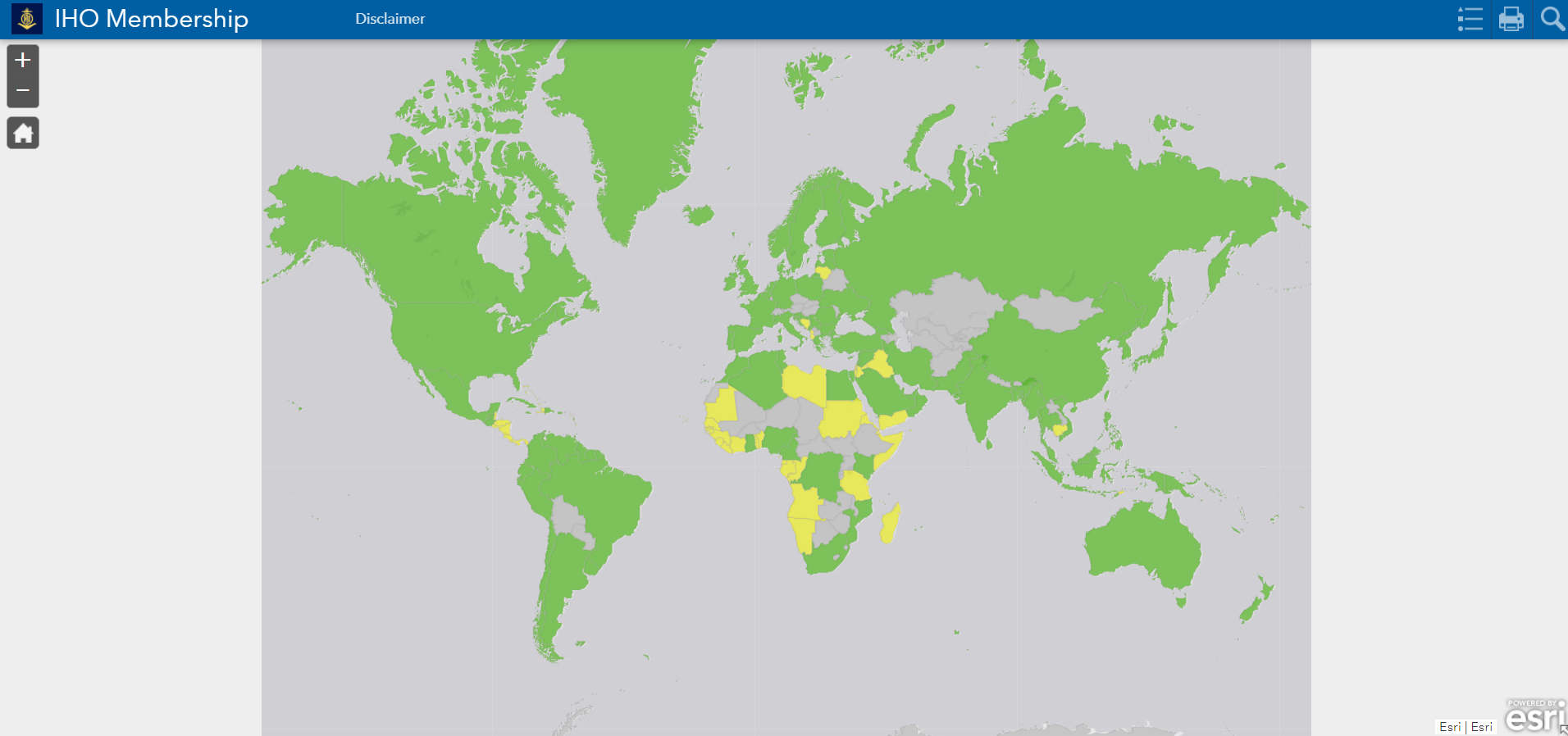
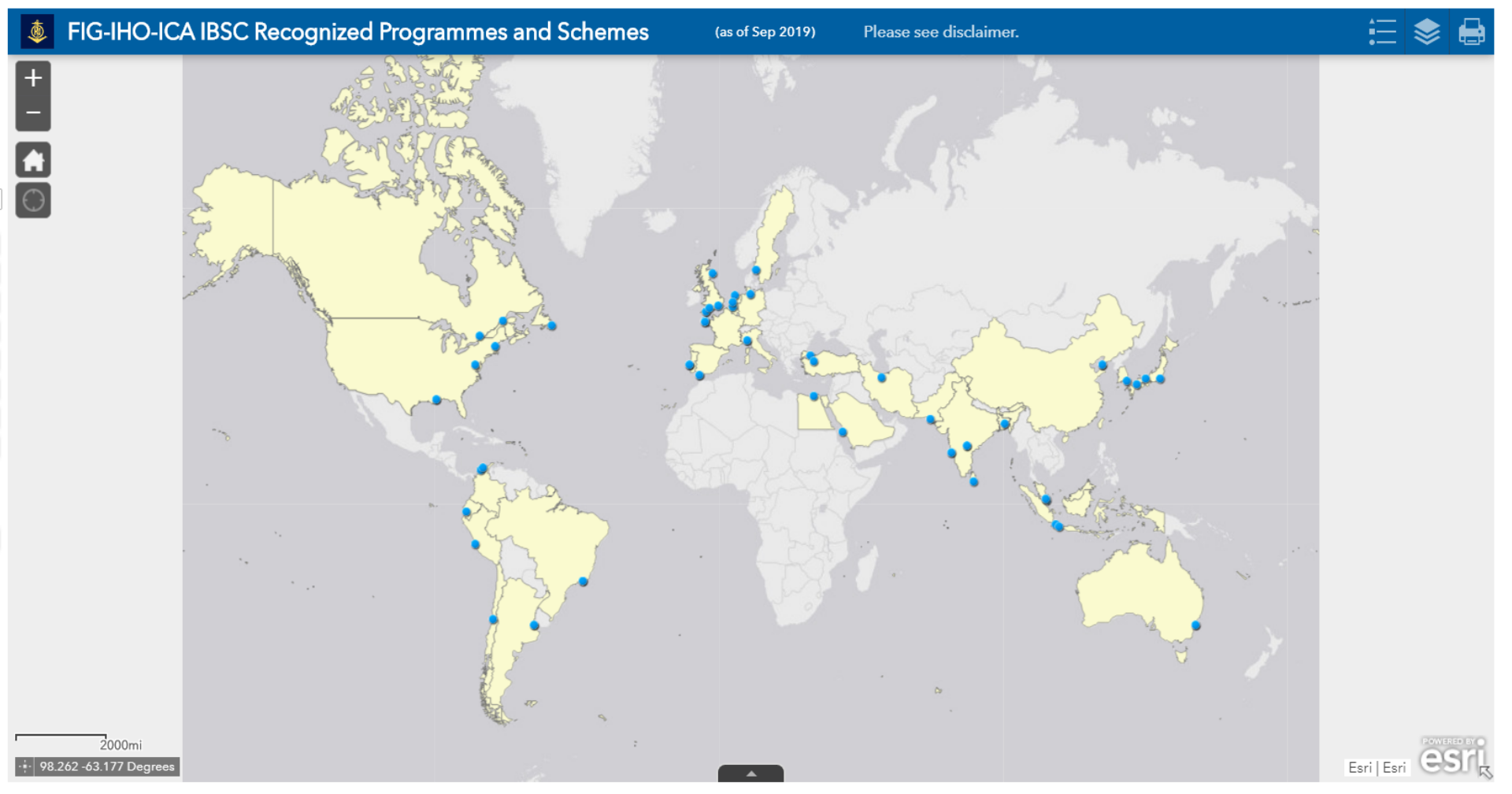
FIG-IHO-ICA IBSC Recognized Programmes and Schemes shows the distribution of the programmes and schemes of capacity building projects.
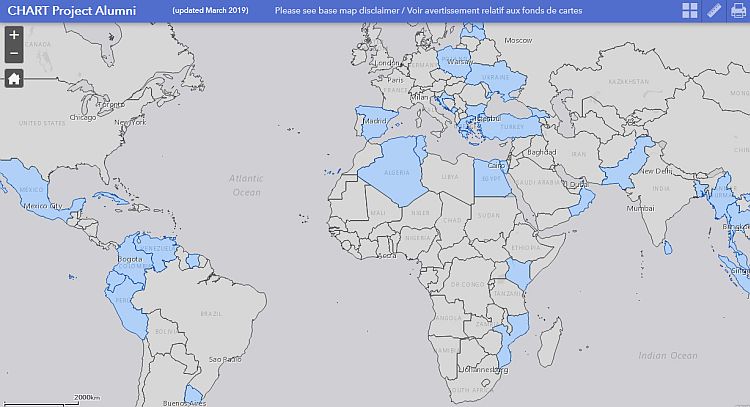
GEOMAC Project shows the distribution of the alumni of the IHO-Nippon Foundation GEOMAC Project.
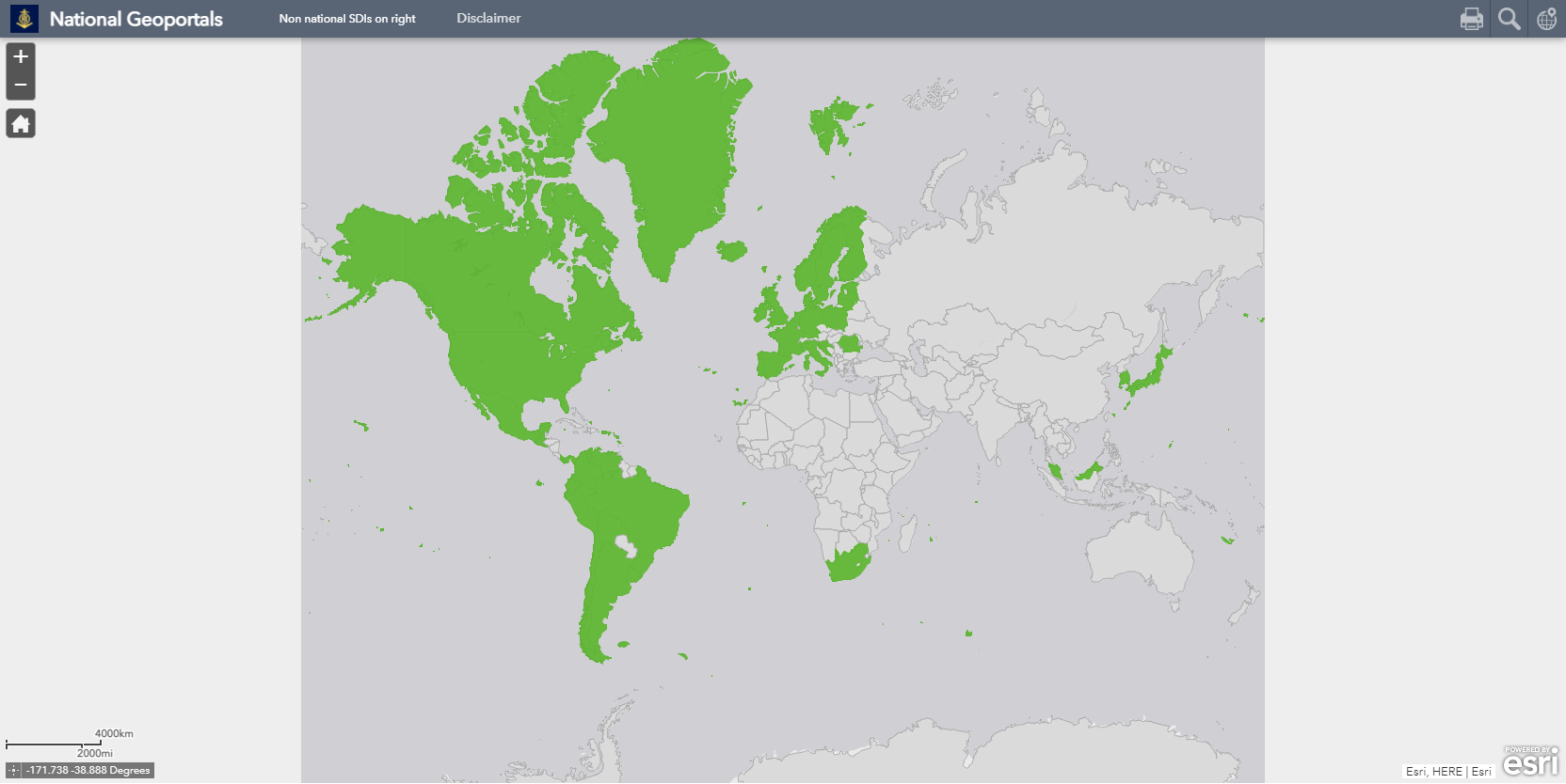
The Map below includes information regarding National Marine Spatial Data Information (MSDI) Portals.


Share this page: