Search results
There are 634 results for “capitulo 1 docx” in All
S100 project
The S-100 Standard is a framework document that is intended for the development of digital products and services for hydrographic, maritime and GIS communities. It comprises multiple parts that are based on the geospatial standards developed by the International Organization for Standardization, Technical Committee 211 (ISO/TC211).
S-100 Standards in Force
Introduction SOLAS regulations V/18 and V/19 requires that, to meet requirements for carrying charts (in terms of SOLAS), the Electronic Chart Display and Information System (ECDIS) equipment must conform to the relevant IMO performance standards. IMO resolution MSC.530(106) applied to S-100 ECDIS and thus in addition to S-57 based standards in force units must also comply with the following:
USCHC44 Meeting (2021)
44th US/Canada Hydrographic Commission (USCHC) Meeting VTC, 18-19 March 2021
SAIHC17 (2021)
SAIHC17 Plenary VTC Meeting 3rd ~4th February 2021
64th Meeting (2021)
NHC64 - VTC Meeting 20th ~ 21st April 2021 LIST OF DOCUMENTS
SAIHC17 (2020)
17th SAIHC Conference Video Tele Conference (VTC) and 9th SAIHC INT Chart Coordination Working Group (ICCWG)
MSDIWG10 (2019)
10th MSDIWG Meeting Busan, Republic of Korea, 4 - 5 March 2019 Followed by the OGC Marine DWG Meeting, 6 March 2019 Followed by the UN-GGIM WGMGI1 Meeting, 7 -9 March 2019 (by invitation only)
S-130PT Meetings
Lists of S-130 Project Team Meetings
S-102PT11 (2022)
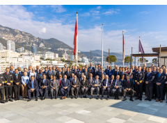
11th meeting of S-102 Bathymetric Surface Project Team (S-102PT11) 8 - 9 December 2022 / Monaco, in conjunction with S-100WG7 meeting


