Data Centre for Digital Bathymetry
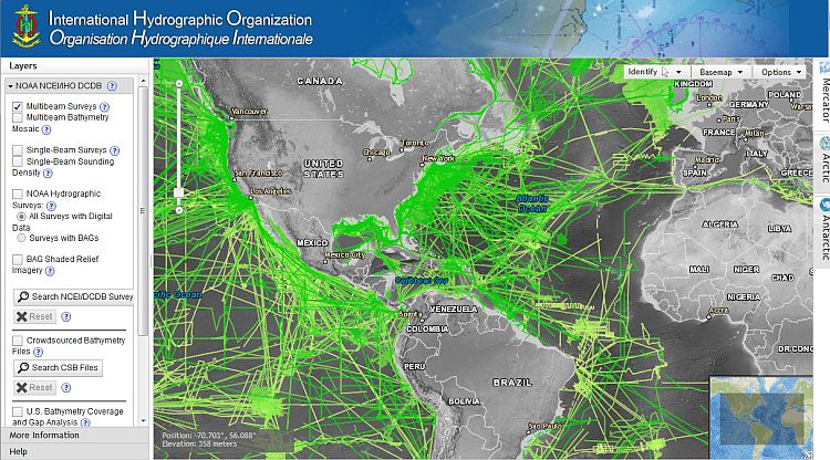
The International Hydrographic Organization Data Centre for Digital Bathymetry (IHO DCDB) was established in 1990 to steward the worldwide collection of bathymetric data. The Centre archives and shares, freely and without restrictions, depth data contributed by mariners. The IHO DCDB is hosted by the U.S. National Oceanographic and Atmospheric Administration (NOAA) on behalf of the IHO Member States.
The DCDB contains oceanic soundings acquired by hydrographic, oceanographic and other vessels during surveys or while on passage. Data are publically available and used for the production of improved and more comprehensive bathymetric maps and grids, particularly in support of the GEBCO Ocean Mapping Programme.
IHO Member States and others can contribute bathymetric data and metadata via File Transfer Protocol (FTP), email, or mail (CD, DVD, and hard drive) in the formats below. Other formats will be considered on a case-by-case basis.
- Raw sonar data: MGD77T or the original manufacturer's format
- Processed data: BAG, NetCDF, tiff, xyz, sd, asc, etc.
- Metadata: XML or text
Do You Know?
-
Detailed knowledge of global bathymetry is critical for understanding how Earth's systems interact and to support coastal zone management, environmental protection, tsunami modelling, inundation forecasting, and charting.
-
The shape of the ocean basins, ridges and mountains influence the flow of sea water carrying heat, salt, nutrients, and pollutants. These features also influence the propagation of energy from undersea seismic events that result in potential disasters such as tsunamis.
-
Less than 15% of our oceans are mapped with in situ soundings, making it critical to preserve and share the data already collected and to identify and work together to fill high priority data gaps to support these important uses.


Share this page: