From ocean mapping to Argo floats: how are we learning about the changing ocean?
Published: 08/04/2022 - 10:21Better ocean data can be used to inform a variety of decisions from storm preparedness to seaweed farming. As part of the Monaco Ocean Week, the IHO hosted an event which provided an overview of some of the work being done to increase our knowledge of the ocean, from Prince Albert I of Monaco’s original idea of ocean mapping to the Argo programme, an exciting, global multidisciplinary project.
over the global ocean down to 1900 meters. © Argo
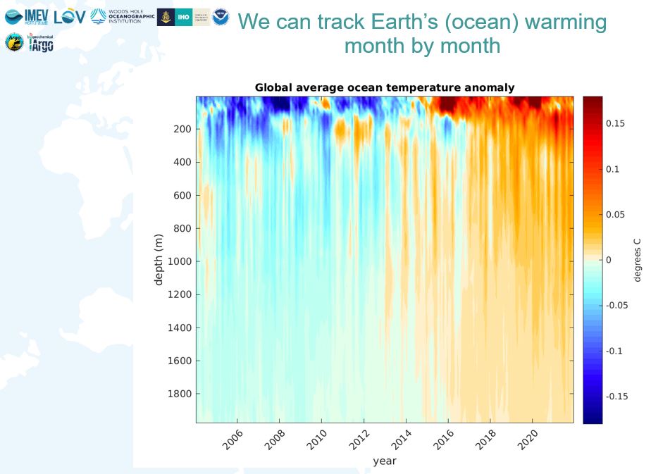
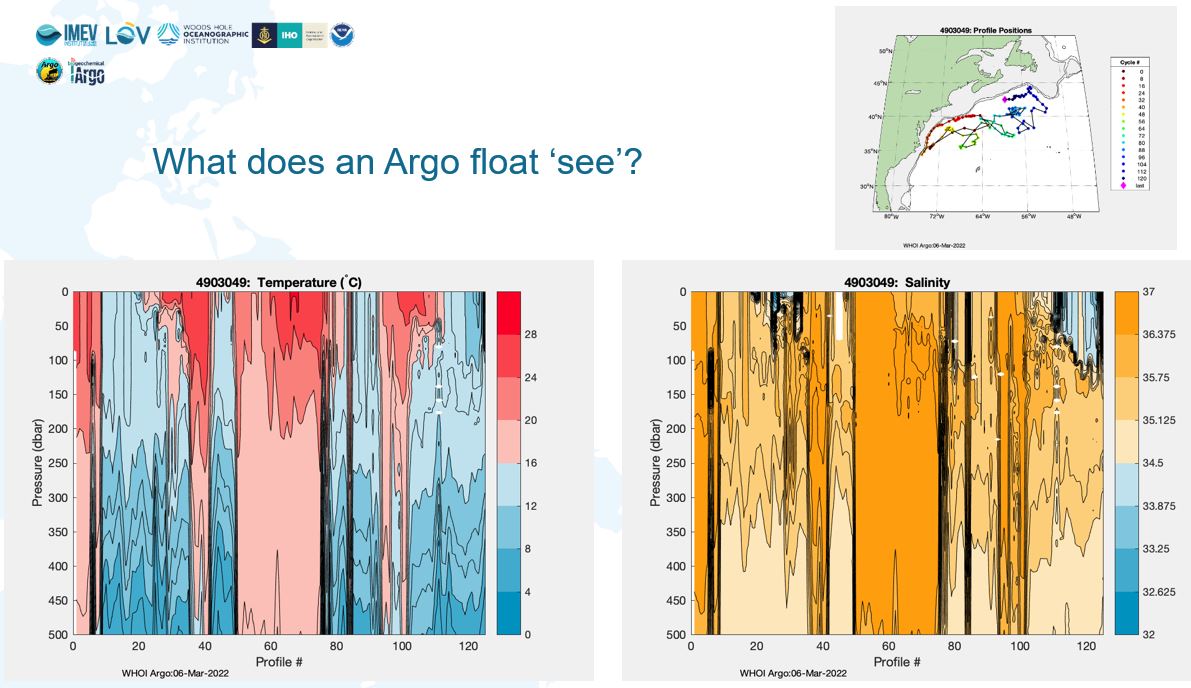
Argo floats provide valuable information on parameters such as temperature and salinity throughout the water column. This sheds light on the “real” temperature profile of the ocean at different depths, as opposed to just the surface. This information is important for a variety of disciplines, including storm preparedness: storms and hurricanes are powered by heat stored in the ocean. The more heat, the more powerful the storm. Thanks to these measurements which started in 1999, we can see very clearly that since 2015 the ocean has been warming at depths up to 2000m. This data can help improve predictions about the intensity of hurricanes, thereby enabling communities to be better prepared for such events. As the oceans are the dominant heat sink in our climate system, Argo also tracks Earths’ warming rate, a crucial metric for understanding present and future climate change and sea level rise.
Participants in the conference learned about a new Argo project to provide data on sea depth. During deployment, Argo floats often touch the sea floor and record when this happens. The IHO initiated a trial project at CSIRO in Australia and funded by the Australian Hydrographic Office to see if accurate and reliable depth data can be extracted from these recordings. Of the 2,7 million data profiles collected, initial analysis shows that up to 8% of these could be groundings: this could potentially reveal 216 000 new depth measurements from around the world. The trial has already provided new data in the Norwegian Sea and in New Zealand, with an excellent median accuracy of 7 or 8m. There are currently 3959 Argo floats operating across the globe.
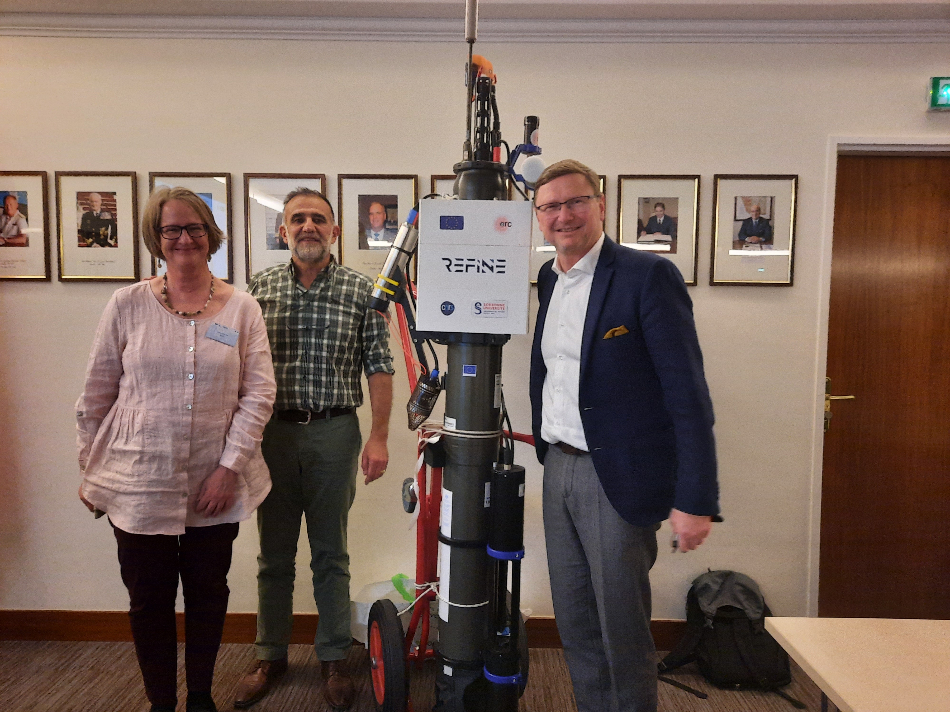
Another innovation presented during the conference was a thermally recharging Argo float equipped with an echo sounder, the first float specifically designed for bathymetry.
While the original impetus to map the ocean was mainly to improve safety of navigation, marine data is now used to inform decisions in a wide array of disciplines including as baseline data to monitor the impacts of climate change or to develop the Blue Economy. Good data can be used for marine renewable energy projects, fisheries and aquaculture, to improve climate models etc. Yet, we currently only have high quality maps for about 20% of the ocean. To help address this, the IHO has several initiatives aimed at increasing knowledge, including a crowd-sourcing project through which privately-owned ships can contribute data gathered with their existing navigation instruments and recorded with inexpensive data loggers.
“Everyone at sea can play a part in increasing our knowledge of the ocean: by facilitating the sharing of data, science is reinforced, safety improves and simply we have a better understanding”
Dr Mathias Jonas, IHO Secretary General
The conference also discussed the latest generation of Argo floats, known as Deep Argo, which can go to depths of up to 6000m and floats with multiple sensors to track the ocean’s chemistry and plankton ecology. It was organized by the IHO and the Argo steering team in partnership with the Argo Project Office (www.argo.ucsd.edu) and the Oceanographic Laboratory of Villefranche (LOV/CNRS).
“The need to better understand our changing global oceans is urgent. We have made great progress, but there is more to do”.
Susan Wijffels, Woods Hole Oceanographic Institution


Share this page: