Lebanon joins the IHO
Published: 29/01/2021 - 14:17Lebanon has joined the International Hydrographic Organization. By becoming its 94th Member State, Lebanon will benefit from the organization’s resources and expertise in order to improve safety of navigation and contribute to the development of its maritime activities.

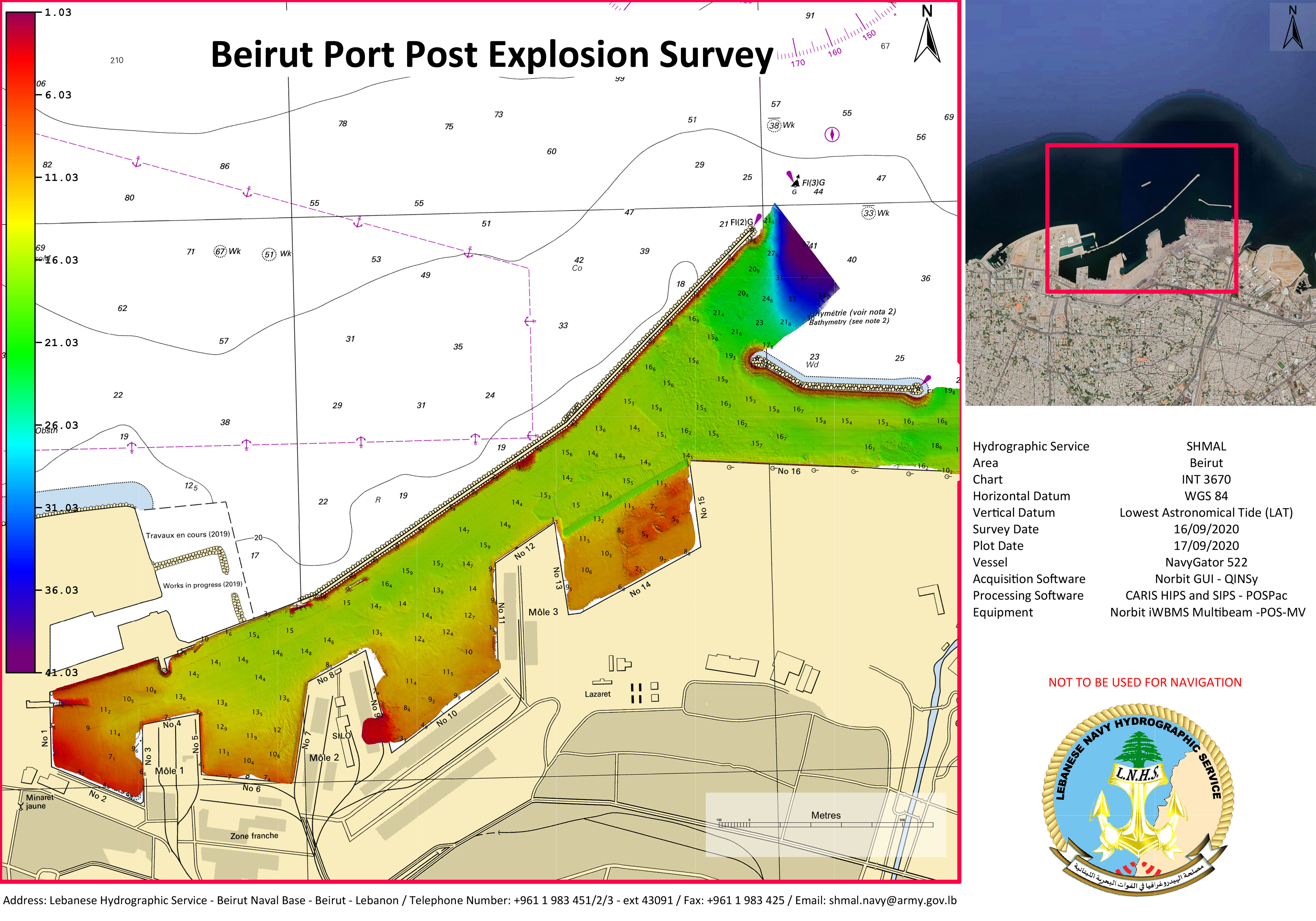
the explosion in August 2020. © Lebanese Navy Hydrographic Service
Beirut harbour is very important for this coastal state, as a strategic gateway for trade and the provision of goods. After the explosion which rocked the capital on 4 August 2020, the seabed around the port was altered. A team of Lebanese hydrographers re-surveyed the port to reopen and enable ships carrying supplies and materials for reconstruction to safely enter.
Lebanon has been collaborating internationally on the topic of hydrography for some years, and has been working closely with Italy on questions such as training and equipment. As a full member of the IHO, it will be able to extend this cooperation to other countries, and participate actively in regional hydrographic commissions on issues of regional importance. It will also be able to participate in the IHO capacity-building programme and receive training for its personnel. It will contribute to discussions on the standardization of maritime data and the transition into the digital age for hydrography.
Knowledge of the seabed, as obtained through surveys, is the base for all maritime activities. By increasing its sea survey capacity, Lebanon will be able to increase the use of its territorial waters and EEZ to develop activities like oil and gas, and gravel extraction. However, hydrographic information has a wide variety of applications. To develop marine renewable energy projects, operators need information related to the topography of the seabed or the strength and regularity of currents. Industries like fishing and aquaculture are also dependent upon environmental factors such as temperature, salinity, and currents - information which detailed hydrographic surveys record.
The IHO is an intergovernmental organization which was created in 1921. It works to ensure all the world's seas, oceans and navigable waters are surveyed and charted. It coordinates the activities of national hydrographic offices and promotes uniformity in nautical charts and documents. It issues survey best practices, provides guidelines to maximize the use of hydrographic survey data and develops hydrographic capabilities in Member States.


Share this page: