Representatives of 98 countries to gather in Monaco for the IHO Assembly
Published: 13/04/2023 - 11:52Representatives of the 98 Member States of the International Hydrographic Organization will gather for the Assembly, Member State and Industry Exhibition from 1 to 5 May 2023. Held every three years, the gathering provides a forum for countries to come together, discuss new developments in technical standards, ocean mapping and agree on resolutions to guide activities. Key topics this year will include the future of charts and steps to ensure the transition to digital data systems.
Countries will also try to reach a consensus on the recognition of the existence and limits of the “Southern Ocean” around Antarctica. In 1929, the IHO recognized the Southern Ocean for the first time. This was followed by several decades of disputes on its geographical limits and queries challenging its existence. In light of the well-established use of the term “Southern Ocean” by geographers and the scientific community, and in order to solve this long lasting issue, the Chair of the Hydrographic Commission on Antarctica who is also Secretary-General of the IHO, submitted a proposal for a new IHO Resolution on this topic. The goal of the resulting discussion will be to agree on cartographic limits while duly acknowledging national positions and possible reservations. The outcome is expected to be an interesting decision which will hopefully put an end to this debate.
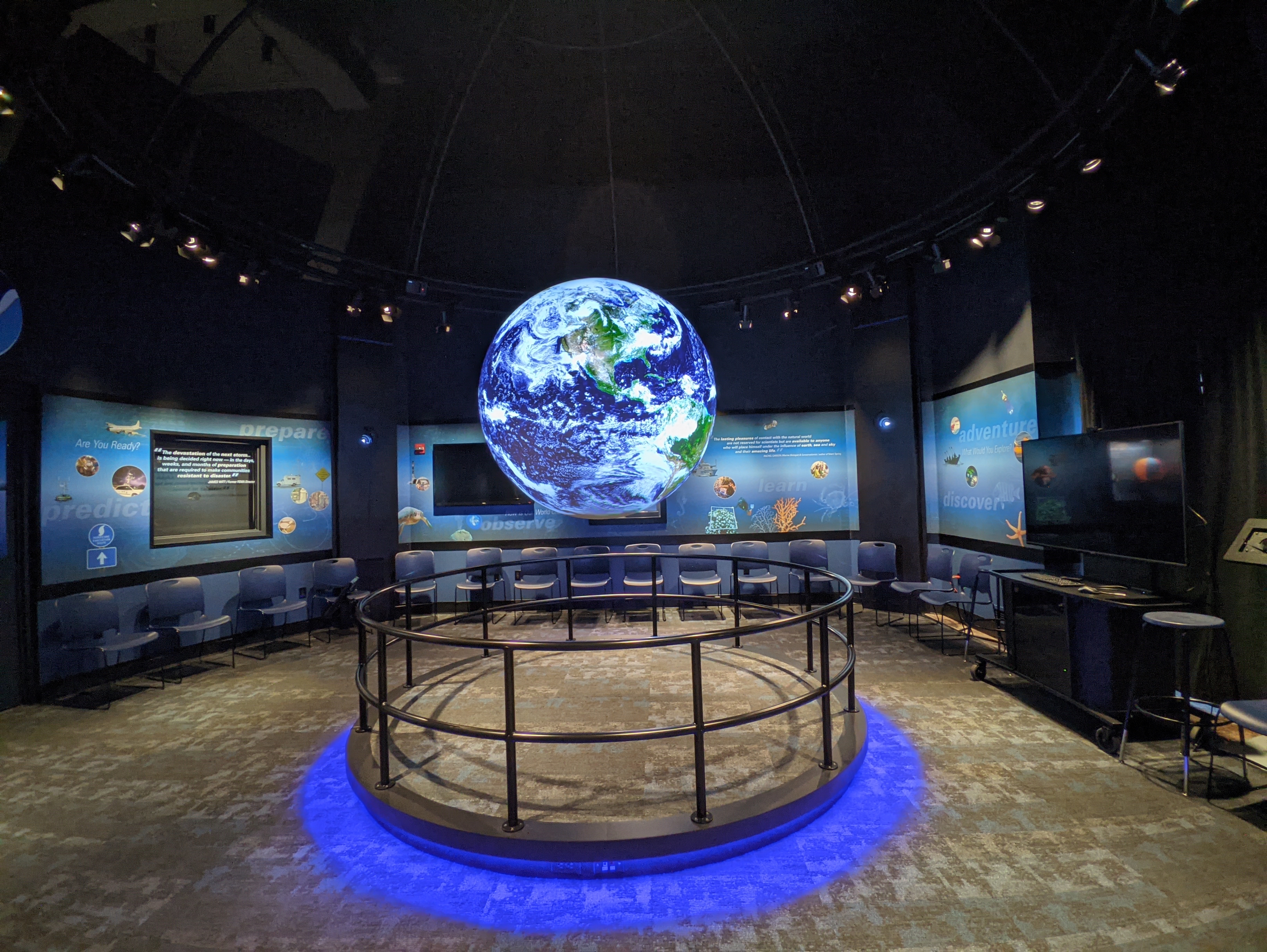
Photo © NOAA.
A key attraction of the Assembly will be the Member State and Industry Exhibitions which will showcase technology and expertise from around the world. The theme of the Member State Exhibition will be “Mapping the marine environment in the Ocean Decade” and will highlight how mapping the ocean can contribute to its sustainable use. The United States will bring NOAA Science On a Sphere® which uses computer and video projectors to display planetary data on a 2 metre sphere in an interactive way. It can project over 1000 data sets including visualisations of ocean currents, temperature, and atmospheric storms.
A 100m long, state-of-the-art survey and research ship, the USNS Bruce C. Heezen from the United States, will come to Monaco for the occasion.
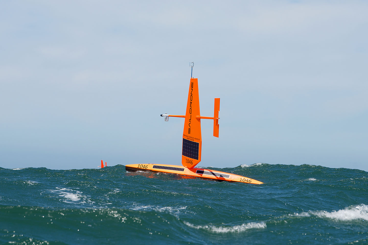
Leading survey and technology companies as well as chart providers will have stands at the Industry Exhibition. Several drones, autonomous and uncrewed vehicles will be on display, including a Saildrone Explorer, similar to the one which sailed inside a Category 4 hurricane, sending back high-resolution images and video in near real time. Saildrone Explorers can stay at sea for up to a year, with the longest mission so far sailing from Rhode Island USA to Cabo Verde, to the Equator, and back, sailing 11,910 nautical miles in 370 days .
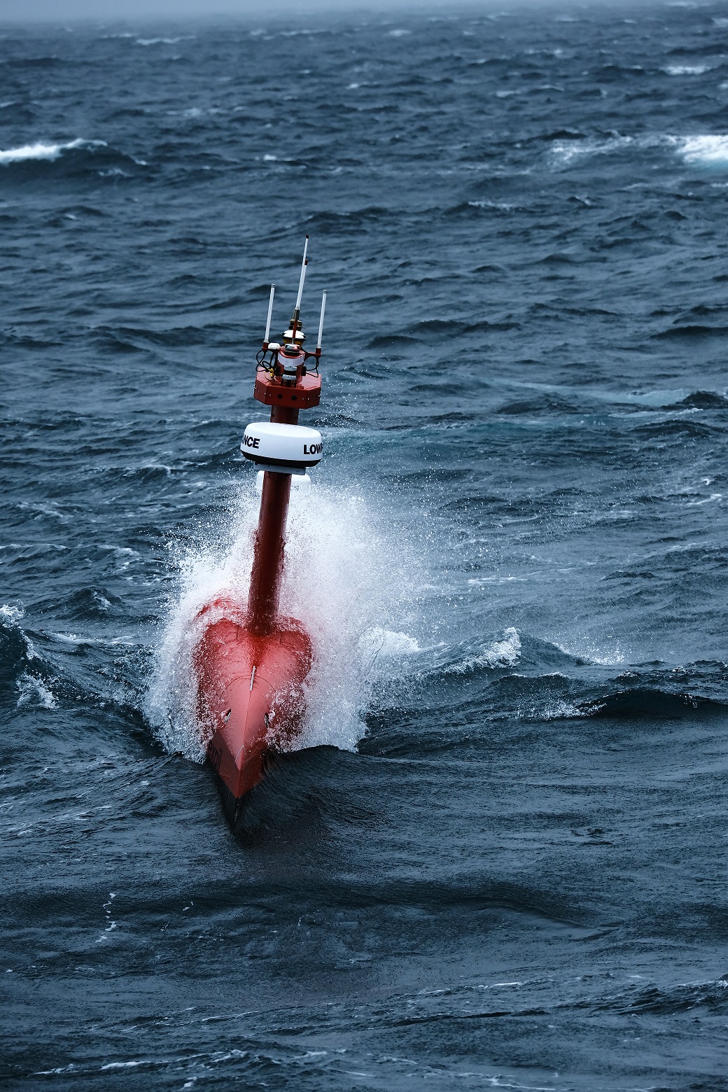
There will also be a DriX, an 8m uncrewed surface vehicle (USV) that can conduct hydrographic surveys as well as subsea asset positioning. Equipped with advanced sensors (radar, lidar, cameras…) and its own artificial intelligence, DriX analyses its environment, avoids obstacles and carries out its missions autonomously. The USV can autonomously map large areas in a reduced amount of time, helping increase the understanding of the oceans. Lighter than traditional vessels, DriX helps reduce the environmental footprint of hydrographic surveys. Compared to traditional survey vessels, it decreases fuel consumption and greenhouse gas emissions by a factor of 50 and reduces radiated noise for greater respect of marine wildlife.
During the opening session on May 2nd, keynote speakers will include HSH Prince Albert II of Monaco and Dr Kerri-Ann Jones, Deputy Secretary General of the OECD. Speakers during thematic sessions on Thursday will include Mark Heine, CEO of Fugro, which specialises in collecting and analysing geo-data to support energy, infrastructure and government decisions as well as Mitsuyuki Unno, Executive Secretary of the Nippon Foundation which supports global efforts to map the ocean.
2023 is a special year as it marks both the centenary of the International Hydrographic Review, the peer-reviewed journal on hydrography, as well as the 120th anniversary of the GEBCO programme. The General Bathymetric Chart of the Ocean was first initiated in 1903 by Prince Albert I of Monaco. With data on seabed topography being used to better understand climate change, marine habitats, the movement of pollutants, tsunami wave propagation and more, having a good map of the oceans is as important as ever.
The culmination of the week will come on Friday 5 May when Member States elect the next Secretary-General and a Director, two key positions which guide the direction and activities of the Organization.
Media enquiries:
Sarah Jones Couture
Public Relations and Communication Officer


Share this page: