Search results
There are 1138 results for “” in All
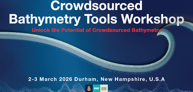
CSB Tools Workshop 2026
Have you considered how your boat's depth soundings could contribute to global databases or local maps? Or how your hardware or software company could support crowdsourced bathymetry (CSB) efforts? If so, and whether you are exploring how to collect and use this data or are already involved in CSB, this workshop is for you!
A4 Industry Exhibition
A key element of the IHO Assembly is the Industry Exhibition, which provides the private sector with a unique opportunity to showcase their technology and expertise to the global hydrographic community, all in one place.
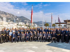
Member States Gather in Monaco for the IHO Council Meeting
Delegations representing Member States of the International Hydrographic Organization (IHO) convened in Monaco last week for the annual meeting of the Council. Participants from 30 Member States sitting on the Council, along with 13 Observers, discussed a wide range of topics including plans for a potential IHO Infrastructure Centre in the Republic of Korea, secure information exchange, and the ongoing transition to digital ocean data systems.
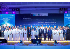
UNCLOS and the international legal framework suitability for ocean activities discussed at ABLOS Conference
The 12th IHO-IAG ABLOS conference brought together participants from all over the world to discuss how the global regulatory framework and the United Nations Convention on the Law of the Sea (UNCLOS) addresses some of today's most pressing ocean-related challenges. Organised in partnership with the Qatari Standing Committee of the Convention on the Law of the Sea, the 280 participants learned about achievements of UNCLOS, challenges it faces in today’s international context, and gaps to be addressed. One question which emerged repeatedly was whether the convention was flexible enough to address modern issues.
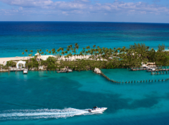
The Bahamas Joins the International Hydrographic Organization
This Move Highlights National Commitment to Maritime Safety, Economic Growth, and Ocean Stewardship The International Hydrographic Organization (IHO) is pleased to announce that the Commonwealth of The Bahamas has officially joined the Organization, marking a significant step in the nation’s efforts to enhance its maritime capabilities and sustainable ocean development.
The Gambia Joins the IHO: Strengthening Hydrographic Capacity in West Africa
The International Hydrographic Organization (IHO) proudly welcomes the Republic of The Gambia as its newest Member State, marking a significant milestone for both the Organization and the West African region. With this accession, the global hydrographic community continues to grow in Africa, underscoring the increasing recognition of the importance of hydrography for safe navigation but also coastal zone management, tourism, UNCLOS obligations and more.

Standards pending entry into force
This page provides a list of IHO standards and product specifications relevant to ECDIS that have been officially published but are not yet in force. These include standards that have been approved and released, but whose implementation dates are in the future, as defined in the S-100 Implementation Roadmap. Only standards that are intended to be implemented in ECDIS are listed here. Each entry includes the publication date, the scheduled date of entry into force, and any applicable notes regarding transition periods or dual-fuel operations. ECDIS manufacturers, hydrographic offices, and system integrators are encouraged to regularly consult this page to prepare for upcoming requirements under the S-100 framework and ensure timely compliance. Date of update: 9 May 2025
AGL& RsWG
African Great Lakes & Rivers Sub-Working Group
MSDIWG
SAIHC MSDI Seabed2030 VTC Meeting 2nd February 2021


