Search results
There are 1117 results for “” in All
64th Meeting (2021)
NHC64 - VTC Meeting 20th ~ 21st April 2021 LIST OF DOCUMENTS
SAIHC17 (2020)
17th SAIHC Conference Video Tele Conference (VTC) and 9th SAIHC INT Chart Coordination Working Group (ICCWG)
USCHC Meetings
List of US / Canada Hydrographic Commission
MEETINGS AFTER 2024
List of the Meso American & Caribbean Sea Hydrographic Commission Meetings Note: To access the meeting page, you'll need an IHO Portal account. If you don't have one yet, don't worry! Creating an account is easy. Simply follow the instruction provided at the link here to set up your account and gain access to the meeting page. Click the IHO Portal to get started
MEETINGS AFTER 2024
List of the South West Pacific Hydrographic Commission Meetings Note: To access the meeting page, you'll need an IHO Portal account. If you don't have one yet, don't worry! Creating an account is easy. Simply follow the instruction provided at the link here to set up your account and gain access to the meeting page. Click the IHO Portal to get started
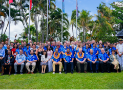
Mapping the Future: Fiji Hosts Pivotal Meetings on Ocean Mapping and Hydrography
Suva & Nadi, Fiji — November 2024 Fiji became the epicenter of global ocean mapping, hydrographic collaboration and geospatial information management as it hosted a series of landmark meetings with a strong focus on Pacific engagement. From the 41st Meeting of the GEBCO Guiding Committee (GGC41) and the 6th Pacific Ocean Mapping Meeting to the subsequent UN workshops on geospatial frameworks and sustainable development, the events underscored the critical role of ocean and data governance for Pacific Island countries and territories.

MSDIWG10 (2019)
10th MSDIWG Meeting Busan, Republic of Korea, 4 - 5 March 2019 Followed by the OGC Marine DWG Meeting, 6 March 2019 Followed by the UN-GGIM WGMGI1 Meeting, 7 -9 March 2019 (by invitation only)
ECS PT meetings
List of ECS Project Team Meetings
ECS PT2 (2024)
2nd Meeting of Electronic Chart System Project Team 21 May 2024 / VTC, 11:00 - 14:00 (UTC+2/CEST) Online Registration / Meeting link (MS teams)


