Search results
There are 238 results for “sea” in All
MSDIWG
SAIHC MSDI Seabed2030 VTC Meeting 2nd February 2021
IHO C-55
The purpose of IHO C-55 Publication (available here) "Status of Hydrographic Surveying and Charting Worldwide" is to provide base data for governments and supporting international organizations as they consider the best means by which to implement responsibilities set out in Chapter V, Regulation 9, of the Safety of Life at Sea (SOLAS) Convention. It also informs IHO input to the United Nations Global Maritime Assessment.
ROPME Sea Area HC
MSDIWG
SAIHC MSDI Seabed2030 VTC Meeting 2nd February 2021
SCUFN
GEBCO SUB-COMMITTEE ON UNDERSEA FEATURE NAMES
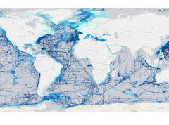
DCDB
In 1988, the U.S. National Geophysical Data Centre (NGDC) offered to host and operate a Worldwide digital oceanic bathymetry data center on behalf of the IHO Member States. This led to the official establishment (in June 1990) of the IHO Data Centre for Digital Bathymetry (DCDB). Data provided by the IHO Member States are available for download from the DCDB web site. It is possible to search, view or download all available data using the DCDB Web Map Server and GEODAS interfaces (please see below).
Mediterranean and Black Seas HC
MSDIWG
SAIHC MSDI Seabed2030 VTC Meeting 2nd February 2021
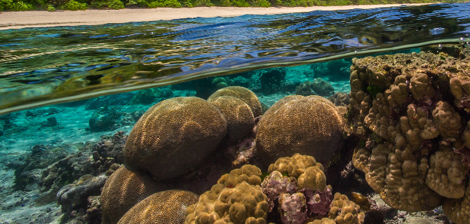
2nd UN Ocean Conference Lisbon
The Stockholm Environment Institute and the IHO are organizing a side-event on seabed mapping & marine data to support multifunctional spatial planning at the UN Ocean Conference in Lisbon. Organized in partnership with IOC-UNESCO, Sweden, the African Union Commission, and the United Kingdom, the event will look at the role of marine data to inform the competing needs of a broad range of ocean stakeholders. Participants will discuss activities, innovations and challenges, as well as technologies and monitoring systems. It will examine how improved data could inform the organization of the marine space to ensure a more sustainable use of ecosystems.