Search results
There are 91 results for “fut monedas Visité Buyfc26coins.com. Servicio confiable y precios excelentes..h67Z” in All
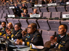
Audience with HSH Prince Albert II & priorities for the new Directing Committee
The new IHO Directing Committee was presented to HSH Prince Albert II of Monaco on Tuesday September 8th 2020.

Vital services continue around the world
Despite the covid-19 pandemic and many people across the world having to work from home, Hydrographic Offices around the globe can be proud of the work they are doing to continue to ensure safety at sea and other vital maritime services. Hydrographic Offices have had to adapt to new circumstances and are successfully ensuring that critical operations move forwards. Maritime Safety Information continues to be shared, NAVAREAs covered, and even the production and maintenance of digital nautical charts (ENCs) and relevant online marine data services is continuing despite constraints linked with the pandemic.
Guidance on use of satellites to gather depth data
The IHO has published the first “Satellite-Derived Bathymetry Best Practice Guide” for the hydrographic community. The new document provides an overview of methods and factors to consider when applying SDB to map shallow coastal environments.

What is progress with crowd-sourced depth data around the world?
The Crowdsourced Bathymetry Working Group met last week to discuss progress on an IHO-led citizen science initiative to collect seafloor depth data. Discussions focused on updating guidance and learning about progress from some of the first trial projects around the world.
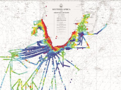
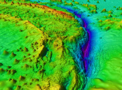
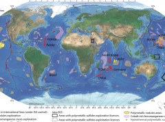
The BGR provides high resolution data for the Pacific and Indian Oceans
The German Federal Institute for Geosciences and Natural Resources (BGR) is participating in the IHO-led efforts to increase knowledge of the ocean and has shared high resolution depth data for the German contract areas for deep-sea exploration granted by the International Seabed Authority (ISA) in the Pacific and Indian Oceans. The BGR provided gridded data for 85.000 km² at a resolution of 120 x 120 meters.
Meeting of the IHO Tides, Water Level and Currents Working Group
The IHO Working Group tasked to monitor and develop the use of tidal, water level and current information as well as to advise on their observation, analysis and prediction, held its 5th meeting 16-18 March.
IHO New Branding
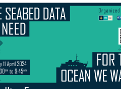
Seabed data to be discussed at the Ocean Decade Conference
The IHO and the OECD are co-hosting a satellite event during the UN Ocean Decade conference in Barcelona. Entitled "The Seabed Data We Need for the Ocean We Want," this session aims to look at the importance of advancing our understanding of the ocean and fostering increased investment in related activities.
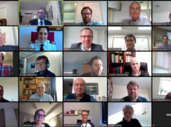
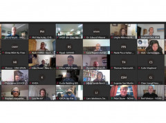
Participants in GEBCO week discuss seafloor mapping and knowledge of the oceans
Over 600 participants from 80 countries gathered online as part of the GEBCO Week to discuss initiatives to map the seafloor and increase our knowledge of the oceans.