Search results
There are 1139 results for “” in All
IRCC15 (2023)
15th Inter-Regional Coordination Committee (IRCC15) Tokyo, Japan 12-14 June 2023 Last Update on the List of Documents: 5 February 2023
IRCC12 (2020)
12th Inter-Regional Coordination Committee (IRCC12) VTC (6-7 October 2020)
IRCC11 (2019)
11th Inter-Regional Coordination Committee (IRCC11) Genoa, Italy (3-5 June 2019)
IHO Technical Standard(old)
Introduction The IHO technical Working Groups, Project Teams and Correspondence Groups conduct the work under the guidance of the HYDROGRAPHIC SERVICES AND STANDARDS COMMITTEE (HSSC). Please see the HSSC page for additional information on the technical standards development activities of the Organization.
ENC Portrayal
Introduction IHO Publication S-52 was developed in conjunction with the IMO Performance Standards for Electronic Chart Display and Information System (ECDIS). It provides specifications and guidance regarding the issuing and updating of Electronic Navigational Charts (ENC), and their display in ECDIS in terms of symbols and colours.
NIPWG
NAUTICAL INFORMATION PROVISION WORKING GROUP
NCWG
NAUTICAL CARTOGRAPHY WORKING GROUP
IRCC
The Inter-Regional Coordination Committee (Programme 3 of the IHO Work Programme) supervises the IHO Capactiy Building Strategy, promotes the wider use and collection of marine data and is responsible for the policy matters related to the Worldwide Electronic Navigational Chart Database (WEND), unless otherwise instructed by the Council. The IRCC coordinates and promotes cooperation with other international and regional organizations in areas of mutual interest, including but not limited to the operation of the World-Wide Navigational Warning Service, the development and maintenance of standards of competence for hydrographic surveyors and nautical cartographers, mapping the seafloor and governing undersea feature names.
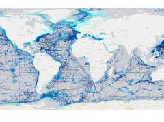
Global seabed mapping reaches new milestone as five million square kilometres added in a year
The Nippon Foundation-GEBCO Seabed 2030 Project announced that 28.7% of the world’s ocean floor has now been mapped, with almost five million square kilometres of data added over the past year.