Search results
There are 1138 results for “” in All
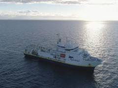
Funded Opportunities for Training & Sea Survey Experience
As part of its ongoing commitment to strengthening hydrographic capacity worldwide, the IHO is pleased to share that several fully-funded opportunities for training and hands-on survey experience are currently open for applications, including a call to participate in a trans-Atlantic hydrographic survey.
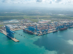
Major Flag State Joins the International Hydrographic Organization
The global hydrographic community expanded in January 2026 with the accession of Panama to the International Hydrographic Organization (IHO), marking a significant milestone for international maritime cooperation. As one of the world’s major flag states and a strategic hub for global shipping, Panama’s membership is expected to strengthen hydrographic capacity and standards worldwide.
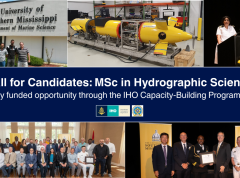
Nominations Open for the MSc in Hydrographic Science
The IHO Secretariat has issued a call for candidates to participate in the Category "A" MSc in Hydrographic Science at the University of Southern Mississippi (USM) as part of the IHO Capacity-Building Programme. Nominations for the 14th cohort of the FIG/IHO/ICA recognized course should be sent by 11 January of 2026.
EU Coastal Nation Joins the IHO
Lithuania has officially joined the International Hydrographic Organization (IHO), becoming its 103rd Member State and marking a historic milestone as now all EU coastal nations are part of this global organization.

Seabed Mapping: Enabling Ocean Action - World Hydrography Day 2025
Seabed mapping supports all activities centred on the ocean, from safety of navigation to marine conservation, marine renewable energy, coastal resilience, and the ocean economy. This includes charting new shipping routes in polar regions to providing up-to-date data to improve climate change models.
4th Session of the Assembly (2026)
4th Session of the IHO Assembly (A-4) Rainier III Auditorium, Monaco 19 - 23 April 2026 Last Update: 10 April 2026
Data Protection (S-100/S-57 )
Introduction The IHO Data Protection Scheme defines security constructs and operating procedures that must be followed by Data Servers (providers of data) and Data Clients (systems that use the data). The purpose of data protection scheme is to provide: 1. Piracy Protection: i.e. to prevent unauthorised use of data by encrypting the ENC information. 2. Selective Access: i.e. to restrict access to ENC information to only those cells that a customer has been licenced for. 3. Authentication: i.e to provide assurance that the ENC data has come from approved sources
S-57 ENC Portrayal
Introduction IHO Publication S-52 was developed in conjunction with the IMO Performance Standards for Electronic Chart Display and Information System (ECDIS). It provides specifications and guidance regarding the issuing and updating of Electronic Navigational Charts (ENC), and their display in ECDIS in terms of symbols and colours.
SAIHC20 (2024)
SAIHC20 Plenary 17 - 19 September 2024/ Kenya (Hybrid) Online Registration


