Search results
There are 87 results for “capitulo 1 docx” in All
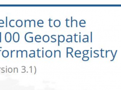
Updated IHO Geospatial Information Registry
The IHO has released an updated Geospatial Information Registry which now contains over 7000 items for the modelling of oceanic data.
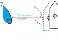
New guide on accuracy of depth information in Electronic Navigational Charts - ENCs
Data provided in electronic navigational charts can vary greatly in accuracy depending on when the sea survey to gather the data was carried out, the type of technology used, as well as the seafloor coverage.
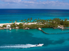
The Bahamas Joins the International Hydrographic Organization
This Move Highlights National Commitment to Maritime Safety, Economic Growth, and Ocean Stewardship The International Hydrographic Organization (IHO) is pleased to announce that the Commonwealth of The Bahamas has officially joined the Organization, marking a significant step in the nation’s efforts to enhance its maritime capabilities and sustainable ocean development.
The Gambia Joins the IHO: Strengthening Hydrographic Capacity in West Africa
The International Hydrographic Organization (IHO) proudly welcomes the Republic of The Gambia as its newest Member State, marking a significant milestone for both the Organization and the West African region. With this accession, the global hydrographic community continues to grow in Africa, underscoring the increasing recognition of the importance of hydrography for safe navigation but also coastal zone management, tourism, UNCLOS obligations and more.
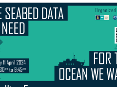
Seabed data to be discussed at the Ocean Decade Conference
The IHO and the OECD are co-hosting a satellite event during the UN Ocean Decade conference in Barcelona. Entitled "The Seabed Data We Need for the Ocean We Want," this session aims to look at the importance of advancing our understanding of the ocean and fostering increased investment in related activities.
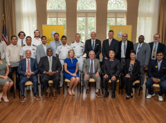
Participants in the IHO – Korea capacity-building initiative graduate from the University of Southern Mississippi
The IHO attended the graduation ceremony for the ten Hydrographic Science students at the University of Southern Mississippi (USM), USA, on Friday 29 July . Of these, three students from Bangladesh, Philippines, and Thailand were part of the Category "A" Master of Science in Hydrographic Science Programme under the IHO-Republic of Korea (ROK) Programme of Technical Cooperation.
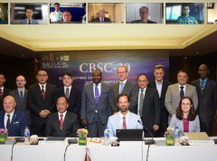
Capacity-Building Sub-Committee discusses new projects and challenges
The Capacity Building Sub-Committee (CBSC) met last week in Denpasar, Bali, for its annual meeting where participants discussed training and education initiatives. Hosted by Pushidrosal, the Hydrographic and Oceanographic Centre of the Indonesian Navy, the gathering enabled the Committee members to review projects such as the IHO e-learning centre and achievements of the Empowering Women in Hydrography project.
Hydrographic Services and Standards Committee discusses progress in standards
Pushidrosal, the Hydrographic and Oceanographic Centre of the Indonesia Navy, hosted the annual meeting of the Hydrographic Services and Standards Committee (HSSC) last week, in Denpasar, Bali.
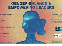
Is gender-balance just a women’s issue?
Do you think gender-balance is “just a women’s issue”? Is it possible some of your actions are influenced by prejudgements based on gender? How could we address these “unconscious biases”?