Search results
There are 94 results for “” in All
Funded Opportunities for Training & Sea Survey Experience
As part of its ongoing commitment to strengthening hydrographic capacity worldwide, the IHO is pleased to share that several fully-funded opportunities for training and hands-on survey experience are currently open for applications, including a call to participate in a trans-Atlantic hydrographic survey.
Major Flag State Joins the International Hydrographic Organization
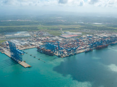
The global hydrographic community expanded in January 2026 with the accession of Panama to the International Hydrographic Organization (IHO), marking a significant milestone for international maritime cooperation. As one of the world’s major flag states and a strategic hub for global shipping, Panama’s membership is expected to strengthen hydrographic capacity and standards worldwide.
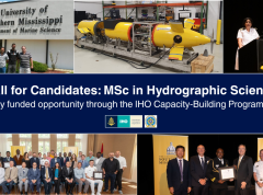
Nominations Open for the MSc in Hydrographic Science
The IHO Secretariat has issued a call for candidates to participate in the Category "A" MSc in Hydrographic Science at the University of Southern Mississippi (USM) as part of the IHO Capacity-Building Programme. Nominations for the 14th cohort of the FIG/IHO/ICA recognized course should be sent by 11 January of 2026.
EU Coastal Nation Joins the IHO
Lithuania has officially joined the International Hydrographic Organization (IHO), becoming its 103rd Member State and marking a historic milestone as now all EU coastal nations are part of this global organization.
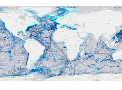
Seabed Mapping: Enabling Ocean Action - World Hydrography Day 2025
Seabed mapping supports all activities centred on the ocean, from safety of navigation to marine conservation, marine renewable energy, coastal resilience, and the ocean economy. This includes charting new shipping routes in polar regions to providing up-to-date data to improve climate change models.
IHO DCDB - temporary app during NCEI outage
Hurricane Helene caused severe damage to several areas of the East Coast of the USA, which in turn has significantly impacted the operations of NOAA's National Centers for Environmental Information (NCEI) in Asheville. Many of their systems including the online access to IHO DCDB-archived bathymetric data are currently down.
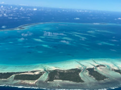
Global hydrographic community grows with 100th country joining the IHO
The Republic of Kiribati has officially become the 100th Member State of the International Hydrographic Organization (IHO), marking a significant milestone for the global hydrographic community. This historic landmark opens up numerous benefits of being an IHO Member State, from helping carry out obligations under the SOLAS Convention, to enhancing safety of navigation, maritime security, fisheries management, economic growth, environmental protection, and climate resilience.
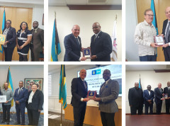
The IHO visits the Commonwealth of the Bahamas
On invitation of the Bahamian Ministry of Foreign Affairs, IHO Director Luigi Sinapi paid a High Level Visit to the Commonwealth of The Bahamas from 15 to 19 April. The Visit was aimed at resuming discussions on the Bahamas’ potential membership to the International Hydrographic Organization and on the progress made in the maritime sector of The Bahamas, to further strengthening the national capacity in the area of hydrography and improving the current Bahamian Maritime National Policy.
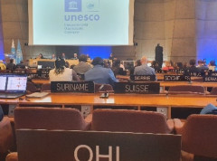
The importance of mapping the ocean is highlighted at the 32nd Session of the IOC UNESCO Assembly
As part of its mission to “participate actively in international initiatives related to the knowledge of the sustainable use of the ocean,” the IHO participated in the 32nd Session of the IOC UNESCO Assembly held in Paris, France from 21-30 June 2023. In addition to engaging in plenary discussions in its role as an Observer, the IHO joined IOC UNESCO in celebrating the 120th anniversary of their joint project, the General Bathymetric Chart of the Oceans (GEBCO).