Search results
There are 94 results for “” in All
Representatives of 98 countries to gather in Monaco for the IHO Assembly
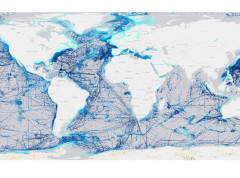
Representatives of the 98 Member States of the International Hydrographic Organization will gather for the Assembly, Member State and Industry Exhibition from 1 to 5 May 2023. Held every three years, the gathering provides a forum for countries to come together, discuss new developments in technical standards, ocean mapping and agree on resolutions to guide activities. Key topics this year will include the future of charts and steps to ensure the transition to digital data systems.
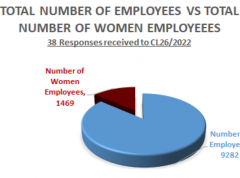
The UN Ocean Decade and the IHO join forces to change the gender climate in hydrography
As part of its mission to induce “transformative ocean science solutions for sustainable development, connecting people and our ocean”, the United Nations Decade of Ocean Science for Sustainable Development (UN Ocean Decade) has endorsed the IHO’s Empowering Women in Hydrography (EWH) project as an Ocean Decade Action.
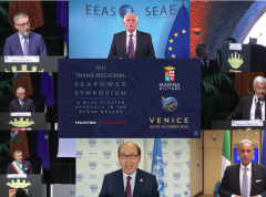
The XIII Trans-Regional Seapower Symposium discusses hydrography’s role in a sustainable Blue Economy
The IHO participated in the XIII Trans-Regional Seapower Symposium held in Venice, Italy from 5-7 October to discuss the IHO’s tasks, mission and challenges within the UN Ocean Decade. Organized by the Italian Navy and hosted in the historical setting of the Arsenal of Venice, the symposium provided an open and inclusive forum where navies, industries, public institutions, academia and international organizations engaged in across-the-board debates involving the diverse community of players in the national and international marine cluster.
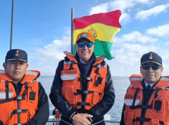
Hydrography for inland waterways discussed during visit to Bolivia
The IHO paid a high level visit to the Plurinational State of Bolivia on 5 and 6 September, during which hydrographic services for inland waterways were discussed. The landlocked nation borders on several lakes, including Lake Titicaca, the highest navigable lake in the world, and also has rivers which form part of the Amazon Basin. These play a vital role in the transport of people and goods in the region.
The IHO welcomes its 98th Member State
The International Hydrographic Organization is increasing its ranks with the accession of Albania as its 98th Member State.
The European Commission and the IHO celebrate 10 years of fruitful cooperation
On 6 May 2022, the European Commission and the International Hydrographic Organization (IHO) celebrated the Tenth Anniversary of the Memorandum of Understanding between the two Organizations at the headquarters of the European Union's DG Mare.
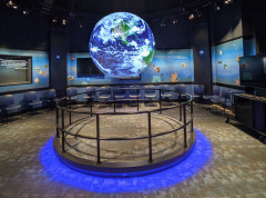
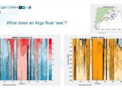
From ocean mapping to Argo floats: how are we learning about the changing ocean?
Better ocean data can be used to inform a variety of decisions from storm preparedness to seaweed farming. As part of the Monaco Ocean Week, the IHO hosted an event which provided an overview of some of the work being done to increase our knowledge of the ocean, from Prince Albert I of Monaco’s original idea of ocean mapping to the Argo programme, an exciting, global multidisciplinary project.
New editor for the International Hydrographic Review
The International Hydrographic Review, the scientific journal published by the IHO, has a new editor. Dr Patrick Westfeld began his new functions on 5 January 2022. He brings with him solid technical knowledge, coupled with good experience with academia and scientific publishing.

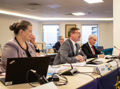
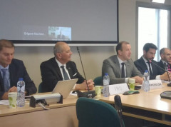
IHO Member States gather for Council meeting
IHO Member States gathered this week as part of the 5th meeting of the Council. Presided by Geneviève Béchard of Canada, participants were able to take stock on progress and discuss next steps on several key actions such as the roadmap for S-100 implementation and the future conversion from S-57 to S-101 ENCs.